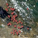
We have a wonderful new tool for showing our supporters the location of our projects.
It gives an idea of how much we have achieved since we began back in ’95. And it’s fun to play with.
You can call up the working map by clicking on this link.
Zoom in and out using the slider on the left. A click on a red marker gives you the name of the project. Every one is a community touched by Quaker Bolivia Link. Thousands of families with lives transformed.
The lake is of course Lake Titicaca, with the Peruvian border down the middle. To the south of that is the huge Altiplano plateau which is at around 12,400 feet above sea level.
Even though you see the mountain range to the east it’s difficult to give an idea of the challenges we face in working in some of the remotest villages.
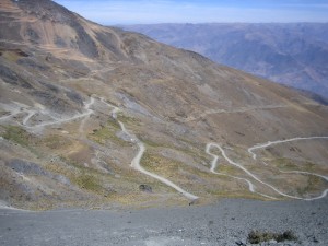
 Pick Ancoma Norte from the list. Reaching this community involves a three hour crossing of a 14,000 ft mountain pass to arrive at the small town of Sorata. After a break in Sorata it’s four more hours on a dirt road over a pass that tops 15,000 feet.
This is how we brought the cement and miles of pipes from La Paz for the village water supply.

